Régions of France
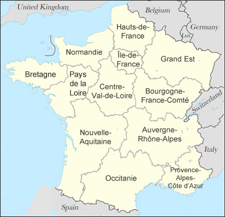
As of January 2016, France has 18 régions, the modern large-scale administrative divisions of the country. The régions, which used to number 22, levy some taxes and administer much of the infrastructure and educational systems in each part of the country.
Thirteen of these régions are in La France métropolitaine (mainland European France plus the island of Corsica); the other five are overseas (French Guiana, Guadeloupe, Martinique, etc.)
Départements
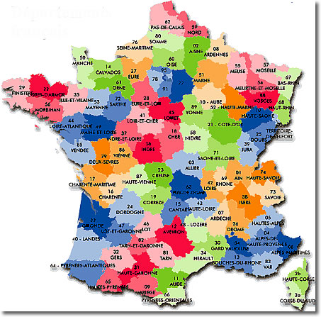
Smaller than the régions, the 96 numbered départements are divisions similar to counties, with administrative powers over some educational institutions, roads, and infrastructure:
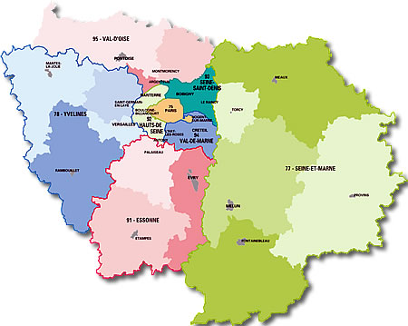
Here's a map of the départements of the Île-de-France région—the region of Paris:
Notice Paris (75) at the center, surrounded by the départements of Seine-et-Marne (77), Yvelines (79), Essonne (91), Hauts-de-Seine (92), Seine-Saint-Denis (93), Val-de-Marne (94), and Val-d'Oise (95). The other names on this map are of the principal towns.
Arrondissements & Cantons
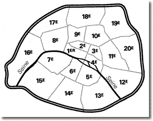
The 96 départements are divided into 323 arrondissements, and the arrondissements are divided into 1,995 cantons. The largest cities—Paris, Lyon and Marseille—are divided into municipal arrondissements as well.
Cantons are subdivided into 36,529 communes.
Communes
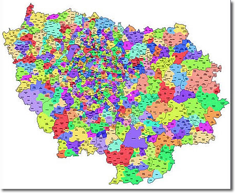
A commune in France is the equivalent of a village, town or township. Here's a map of all the towns in the Île-de-France, the region surrounding Paris:
It Gets Worse...
France also has communes associées, communautés urbaines, communautés d'agglomération, communautés de communes and even more obscure local administrative divisions. You may notice these names, but you don't have to learn them!