| Transport for Château-Thierry, France | ||
| Though it's 96 km (60 miles) from Paris, Château-Thierry is in fact a distant suburb of the capital, reachable by train in less than an hour. | ||
|
|
|
TrainChâteau-Thierry, 96 km (60 miles) northeast of Paris (map), is connected to Paris's Gare de l'Est by TER regional trains in less than an hour, as well as by slightly slower but more frequent Transilien P Line commuter trains from Gare de l'Est taking slightly over one hour. The Gare de Château-Thierry SNCF train station is 1.2 km (3/4 mile) south of the city center (Hôtel de Ville), a 15-minute walk (map). CarDriving, you follow the fast A4 autoroute (expressway) (map). Local TransportChâteau-Thierry's local city bus transport is operated by Fablio. It's 1 km (6/10 mile, a 15-minute walk) from the Gare de Château-Thierry SNCF train station to the central Place Jean de la Fontaine, but you can take a local city Bus 2 right from the station for this trip. Bus 3 toward Buisson can take you uphill toward the Château-Thierry American Monument, shortening the walk to that site. More... You can buy a ticket right on the bus.
|
|
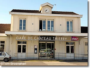
The Gare de Château-Thierry SNCF train station.
|